Description of the Field
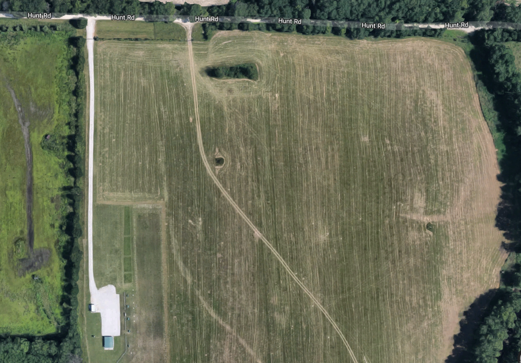
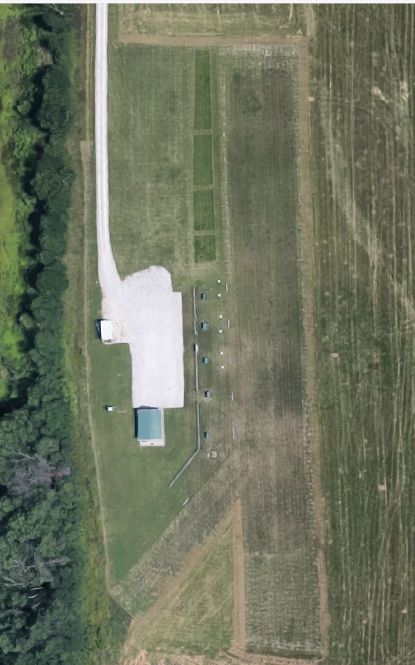
The MMRCA flying field is leased from the City of Columbia. The property that the club uses is maintained by the club. This includes the gravel from Coats Lane to the parking lot, the maintenance of the runway, mowing of the runway, pits and immediately adjacent areas. There is several hundred acres of city property adjacent to the club leased area that is hayed off a once or twice a summer. This provides a buffer between the club and the nearest houses, roads, etc. The runway is shortly mowed grass that is approximately 675 ft long and approximately 100 ft wide. The north end of the runway is about 500 ft from Hunt road. The south end of the runway is more than 1500 ft from the tree line of the Katy Trail. The tree line to the east, at its closest point, is approximately 700 ft from the runway.
The spectator area is separated from the pits via chain linked fence. The Pit area consists of several work tables, plane starting tables, and concrete pads for engine starts. The Pit area is separated from the runway with PVC framed/netting for the pilot stations.
The parking lot is gravel with a covered area that houses several picnic tables. This provides a shaded areas that is great for hosting fun fly lunches. A porta-potty is also kept/maintained west of the parking lot.
Directions To New Field
Longitude 92o 25' 16", Latitude 38o 55' 45"
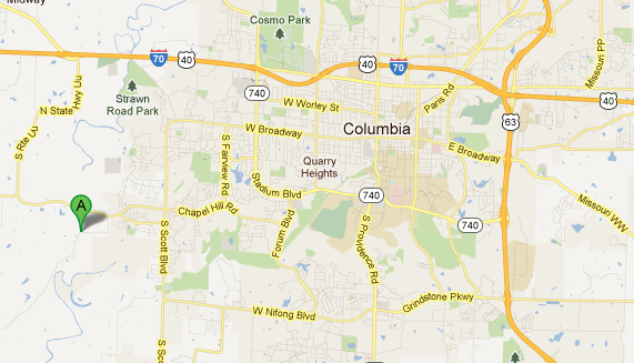
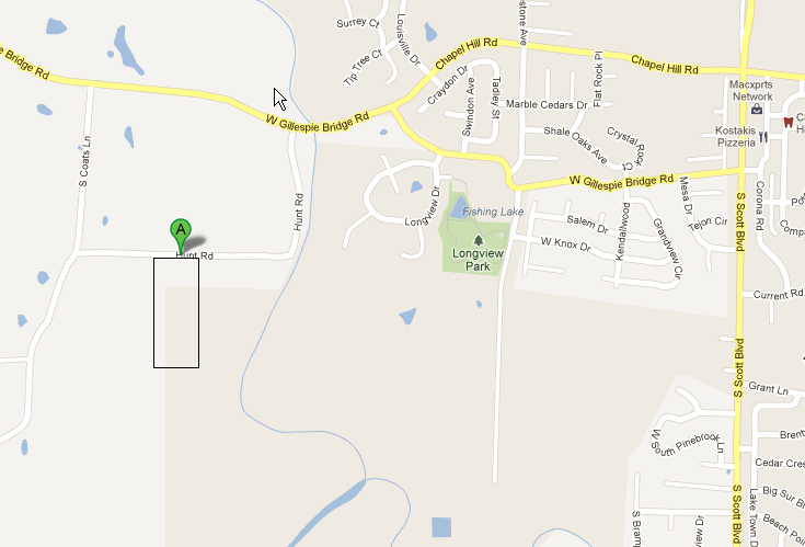
From within Columbia, Missouri: Go to Chapel Hill Road and Scott Blvd. Go west on Chapel Hill Road 1.5 miles. You will go through the housing area, down the hill and across the bridge. The first road after the bridge is Hunt Road (which is blocked with a road closed). DO NOT TAKE HUNT ROAD! Look for Coats Lane (the next road), turn left. Go approximately 0.2 of a mile on Coats Lane. The first street on the left is Hunt Road. You might miss the road if you don't pay attention. About 1/4 mile you will see our MMRCA sign on the right. This will be our field. We have installed our own gate.
From I-70: Take Stadium exit south to Broadway, turn right. Follow Broadway west past WalMart and HyVee. Shortly the road will turn left (south) and change to Scott Blvd. Turn right at Chapel Hill Road and follow the the directions above.
From I-70 (Alternate Route): Take Midway exit (Exit 121), follow State Route UU south, approximate 3.3 miles to W Gillespie Bridge Road, turn Left. Follow W Gillespie Bridge Road for 2.2 miles and turn right onto Coats Road. Hint: Watch for "Flood Area Ahead" sign. Coats Road is right after the sign. Take first left onto Hunt Road. Field 1/4 mile on right.
From South 63 (Jeff City and Beyond): Take Grindstone or AC Exit, turn left. Following Grindstone Blvd all the way to the end, approximately 5.8 miles, to Scott Blvd. Along the way Grindstone Blvd will turn into Nifong Blvd. At the end, turn right on Scott Blvd, go approximately 1.5 miles to Chapel Hill Road, then turn left on Chapel Hill. Follow the directions from the first paragraph.
Alternate Route From South 63 (Jeff City and Beyond): From Hwy 63, take Stadium Blvd exit, turn Left and follow Stadium through the MU Campus until Forum Blvd. Left on Forum Blvd, go 2 lights, turn right on Chapel Hill Road. Cross Scott Blvd and follow instructions above (1st set of instructions above).
Please review the MMRCA Flight Guidelines
Area Map To The Field

Local Map to the Field

Pictures of the Field

